Winter Storm Warning Issued as Up to 2 Feet of Heavy Snow Targets 3 States This Weekend
America’s 250th birthday is now just around the corner, and millions of families across the United States are already looking ahead to the long July 4th weekend. Cookouts, road trips, fireworks, lake days, national parks, and mountain getaways are all moving onto the calendar.
But before the country reaches that summer celebration, parts of the Northern Rockies are being pulled straight back into winter.
A powerful late-June storm is expected to bring heavy snow, dangerous backcountry travel, bitter mountain conditions, and possible road hazards across parts of Idaho, Montana, and Wyoming this weekend. While much of the country is dealing with heat, humidity, and summer storms, high-elevation areas in these three states are preparing for snowfall totals of up to 24 inches.
The warning is especially serious because of the timing. Late June usually brings hikers, campers, anglers, RV travelers, and families into the mountains. Many people pack for cool nights, not full winter conditions. That could become a dangerous mistake this weekend as wet, heavy snow moves into mountain passes and backcountry areas.
Up to Two Feet of Snow Coming
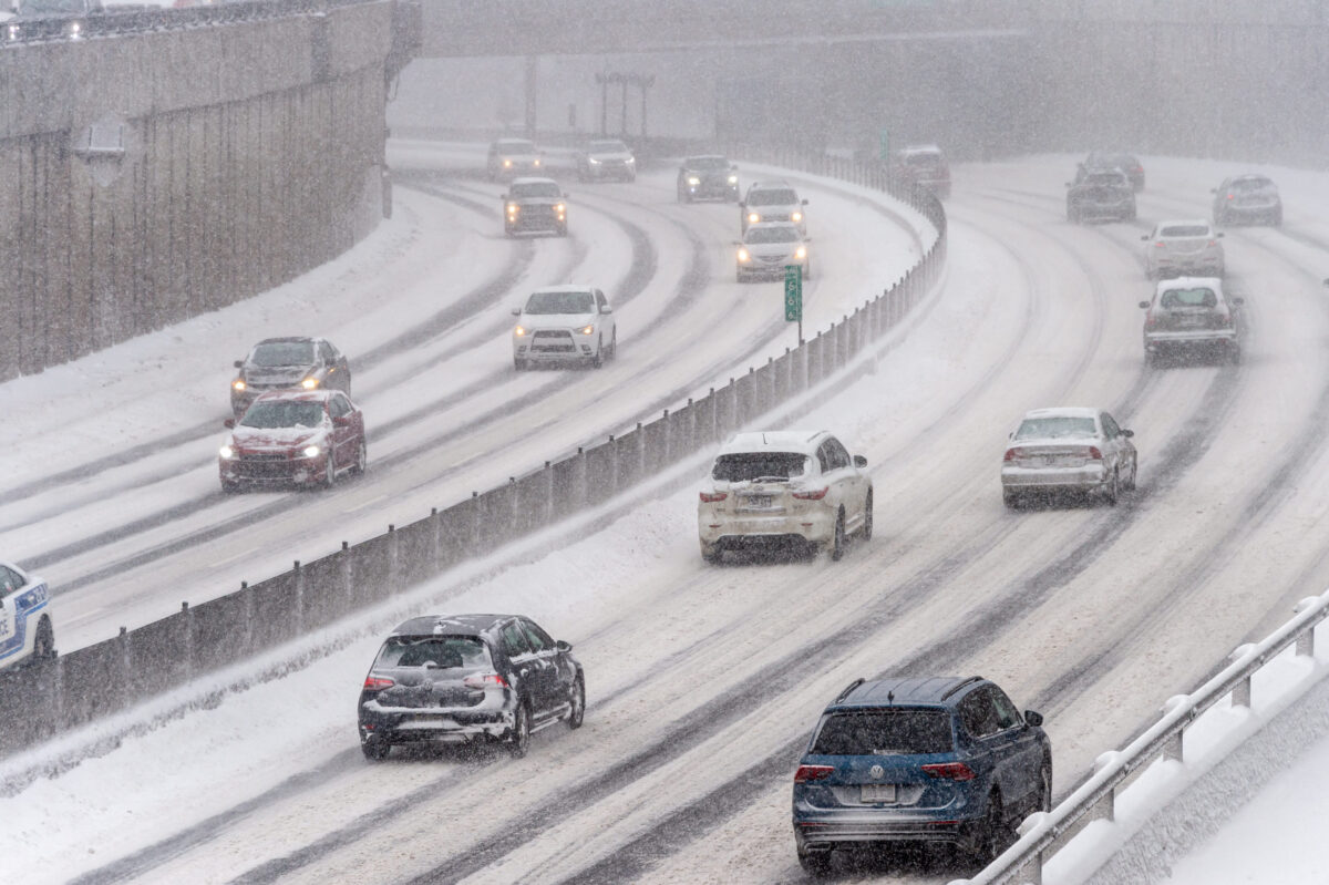
The heaviest snowfall is expected mainly at higher elevations, especially above 6,500 feet, where temperatures will be cold enough for rain to change to accumulating snow. According to the National Weather Service office in Great Falls, mountain snow is expected to begin Saturday night and continue into Monday morning.
This is not a light dusting meant only for scenic photos. Some mountain areas may see enough snow to block roads, weigh down trees, and strand anyone unprepared for winter-like travel. The National Weather Service has urged people who are not ready for snowy backcountry conditions to move to lower elevations before the storm arrives.
The heaviest amounts are possible around Georgetown Lake in Montana, where snowfall totals could reach up to 2 feet by the time the system moves out. That kind of snow in late June can quickly turn remote roads into traps, especially when it’s wet and dense.
The Bitterroot and Sapphire Mountains are also expected to see significant snow, especially near Skalkaho Pass and Nez Perce Pass. The highest passes in that region could pick up as much as 12 inches of snow, making travel difficult for anyone crossing exposed mountain routes.
In Idaho, 4th of July Peak may live up to its name in the most ironic way possible. Instead of sunshine and patriotic weekend preparations, the area could see up to 10 inches of snow. Farther south and east, Wyoming’s Gannett Peak could receive close to one foot of snow, adding another state to this unusual late-June winter setup.
Idaho, Montana, and Wyoming Face Weekend Travel Threats
The storm is expected to hit some of the most rugged and recreation-heavy parts of the region. These are areas where people often travel far from major services, cell reception, and fast emergency access. That makes preparation more important than usual.
In Montana, the main concern is the high country, where heavy snow may impact mountain passes, forest roads, campgrounds, and backcountry access routes. Areas around Georgetown Lake and the higher terrain of the Bitterroot and Sapphire ranges could see some of the most difficult conditions.
In Idaho, the snow threat is focused on mountain elevations, including places that outdoor travelers may still be trying to access for camping, hiking, or scenic drives. A place like 4th of July Peak, receiving snow right before America’s biggest summer holiday, serves as a sharp reminder that mountain weather does not follow the calendar.
In Wyoming, the risk is tied to the highest terrain, including Gannett Peak. Even if most communities do not see major winter impacts, the backcountry may become dangerous for anyone who underestimates the storm.
We should make one thing clear: this is not a widespread city snowstorm. Lower elevations may deal with rain, cold winds, and raw weather instead of major snow accumulation. But in the mountains, the difference of a few thousand feet can completely change the story.
A valley may look wet and manageable. A nearby pass may be snow-covered, slick, and dangerous.
Heavy Wet Snow Could Bring Down Trees and Block Roads
The biggest concern is the weight of the snow. Late-season snow often carries more moisture than midwinter powder, making it heavier, stickier, and more damaging. When that type of snow collects on trees, branches can snap and fall across roads or trails.
That becomes a serious issue in the backcountry. A downed tree on a remote road can block vehicles from leaving. Several downed trees can trap campers, hikers, or drivers for hours. If snow continues falling while temperatures drop, the situation can become more dangerous quickly.
Heavy wet snow can also cling to tents, vehicles, power lines, and gear. Campers who are already set up in high-elevation areas may wake up to sagging tents, soaked equipment, and blocked access roads. People who arrived expecting a summer weekend may find themselves facing a storm that feels more like early winter.
The National Weather Service has warned that people should consider delaying travel across the backcountry and higher elevations. That warning is not just about slippery roads. It is about the full combination of snow, cold, falling trees, poor visibility, and limited access.
Hypothermia Risk Rises for Campers and Hikers
The storm also poses a serious risk of hypothermia for people staying in the mountains. Hypothermia can happen when the body loses heat faster than it can produce it, and wet conditions make that danger worse.
Cold rain, snow, wind, and soaked clothing can become dangerous even when temperatures are not far below freezing. A person hiking in light summer gear may start the day feeling comfortable at a lower elevation, then encounter cold rain or snow without enough protection.
That is why this storm matters for outdoor recreation. It is easy to underestimate late-June snow because the season feels wrong. But the body does not care what month it is. Wet clothes, cold air, and wind can still create a dangerous situation.
Anyone already in the backcountry should reassess their plans immediately. If the route goes above 6,500 feet, the risk increases. If the trip depends on a narrow mountain road, an exposed pass, or a remote trailhead, the risk increases even more.
Winter Storm Kit Recommended for Essential Travel
For people who must travel through the affected mountain areas, a winter storm kit is strongly recommended. That kit should include tire chains, booster cables, a flashlight, a shovel, blankets, extra clothing, water, and a first aid kit.
Drivers should also bring food, phone chargers, gloves, waterproof layers, and anything needed to survive if stranded. In remote mountain terrain, help may not arrive quickly. A simple delay can become dangerous when temperatures drop, and snow continues falling.
Travelers should check road conditions before leaving and avoid assuming that a route is safe just because it was open earlier in the day. Mountain roads can change fast. Snow may begin as slush, then build into a heavier layer. Falling branches may appear without warning. Visibility may drop quickly as snow, fog, and wind move through the passes.
Anyone pulling a trailer, driving a low-clearance vehicle, or using worn tires should be especially cautious. Wet snow can make steep roads difficult even for experienced drivers.
Winter Weather Hits Just Before July 4th Celebrations.
The timing gives this storm an unusual edge. America is preparing for a major patriotic milestone, with the nation’s 250th birthday approaching and July 4th travel already on many calendars. Yet in the Northern Rockies, some people may spend the weekend dealing with snow shovels, tire chains, and warnings about mountain roads.
That contrast makes the storm feel even more dramatic. Across much of the country, late June means swimming pools, backyard grills, baseball games, and fireworks stands. In parts of Idaho, Montana, and Wyoming, it may mean snow-covered peaks, slick passes, and dangerous conditions for anyone caught unprepared.
We should not treat this as a novelty forecast. Yes, late-June snow is striking. Yes, it makes for a surprising headline. But for people in the affected mountain areas, the risk is practical and immediate.
Campers may need to move. Hikers may need to cancel routes. Drivers may need to delay travel. Backcountry travelers may need to get below the snow level before conditions worsen.
Winter Storm Warning Remains in Effect Through Monday Morning
The Winter Storm Warning is expected to remain in effect from Saturday night through Monday morning. During that window, the highest elevations in parts of Montana, Idaho, and Wyoming may see the most difficult conditions.
Snowfall totals will vary sharply by elevation. Some areas may see only several inches. Others, especially near the highest peaks and favored mountain zones, may see totals closer to a foot or more. Around Georgetown Lake, the forecast calls for up to 24 inches.
The message for the weekend is direct: do not let the calendar create a false sense of safety. Late June can still deliver winter in the mountains, and this storm may do exactly that.
For residents, visitors, campers, hikers, and road-trippers, the safest move is to prepare early, delay risky travel, and respect the warning. A summer weekend can turn dangerous fast when the mountains decide winter is not finished yet.