10 Perilous Hikes Still Open to the Public Today
These perilous hikes, still open to the public, prove that beauty, danger, and strict preparation often share the same trail.
Some trails do not simply ask hikers to walk. They ask them to judge weather like a pilot, read terrain like a rescuer, respect local rules like a conservation officer, and carry fear without letting it make the decisions.
The world’s most perilous hikes are not open because they are harmless. They remain open because trained authorities, local communities, and experienced adventurers have found ways to manage danger without removing the wildness that makes these routes unforgettable.
We should treat these hikes as public privileges, not casual sightseeing stops. A reservation, helmet, harness, mountain hut booking, backcountry permit, or weather check is not red tape when the trail includes cliffs, flash floods, altitude, avalanche terrain, rockfall, or a one-way boardwalk above a gorge.
These routes reward planning, patience, and humility. They punish rushing, ego, and “it will probably be fine” thinking.
Mount Huashan Plank Walk in China

Mount Huashan does not need horror music to feel dramatic. The mountain rises in steep stone folds, with stairways, temples, chains, cliffs, and one legendary plank section that has become one of the most recognizable cliff walks in the world.
The Plank Walk sits on the eastern side of the South Peak, with sections that narrow to about 0.3 meters and hang over a vertical drop of hundreds of meters.
The modern version is safer than its reputation suggests, as visitors use compulsory harnesses and move along fixed chains, yet the psychological challenge remains sharp enough to make confident hikers suddenly fall silent.
The real danger here is not only the drop. It is the mix of crowd pressure, shaky nerves, narrow footing, and the temptation to treat a sacred mountain like a social media stunt. We should approach Huashan as a mountain pilgrimage first and a thrill second.
Small daypacks, grippy shoes, gloves, and calm movement matter more than brave poses. The mountain is open all day, with April through October listed as the best visiting period, but the plank section demands clear weather, dry footing, and the discipline to turn back if congestion builds.
El Caminito del Rey in Málaga, Spain

El Caminito del Rey may be safer today than its old “world’s most dangerous walkway” nickname suggests, but that does not make it ordinary.
The restored trail follows a dramatic one-way path through the Desfiladero de los Gaitanes, where boardwalks cling to limestone walls, and the gorge drops away beside your shoulder.
Modern guardrails, timed tickets, helmets, staff supervision, and controlled flow have changed the experience from reckless ruin-walking into a regulated adventure. Still, exposure to heights can unsettle visitors who normally feel confident on regular trails.
The rules are part of the experience, not an inconvenience. Children under 8 are not allowed; helmets must be worn; the route is linear; and visitors must arrive before their entry time.
The path is not recommended for people with severe vertigo, heart or lung conditions, or poor fitness, and there are no bathrooms along the route.
We should bring water, light snacks, hiking shoes, sun protection, and only a small bag. El Caminito proves that a dangerous trail can remain open when engineering and visitor behavior work together.
Kalalau Trail on Kauai’s Nā Pali Coast
The Kalalau Trail looks like paradise, then quickly reminds hikers that paradise has teeth. This 11-mile coastal route crosses steep valleys, slippery red dirt, exposed sea cliffs, stream crossings, humid forest, and remote terrain before reaching Kalalau Beach.
Hawaii State Parks describes it as one of the world’s adventurous hiking trails and notes that anyone going beyond Hanakāpīʻai Valley must have a valid overnight camping permit.
Day hikers can enjoy the early section, but the full route is not meant to be rushed as a 22-mile out-and-back sprint.
The trail’s most frightening hazard is water. Streams can rise fast, and official visitor guidance warns hikers not to cross when water is rushing or murky. That advice sounds simple until a tired hiker is standing near a swollen crossing, hungry, wet, and desperate to get back.
We should shelter in place during dangerous stream levels rather than force a crossing. There is no cell service in much of the area, no drinking water in the wilderness park, no trash service, and stream water must be treated before drinking.
Half Dome Cables in Yosemite National Park

Half Dome is one of America’s great hiking symbols, but the final cable section is not just a dramatic finish.
It is a steep granite test of grip, composure, spacing, weather judgment, and leg strength after many miles of climbing. Yosemite requires permits seven days a week whenever the cables are up.
The cables are normally installed from the Friday before Memorial Day through the day after the second Monday in October, with dates still subject to conditions. The daily limit beyond the base of the subdome is 300 hikers, divided between day hikers and backpackers.
The main mistake on Half Dome is treating the permit as the hard part. Winning access does not make the rock dry, the sky safe, or the body ready.
We should start early, carry enough water, use gloves with a good grip, wear shoes that bite into granite, and leave the cables immediately if thunderclouds build.
The descent deserves the same respect as the climb because tired arms and crowded cables can turn impatience into danger. Half Dome remains open because Yosemite manages access tightly, but the mountain still demands old-fashioned caution.
Aonach Eagach Ridge in Scotland
Aonach Eagach is not a casual ridge walk with a scary reputation tacked on. The British Mountaineering Council calls it Glen Coe’s legendary Grade 2 scramble and describes it as one of the narrowest and most serious ridge experiences on the British mainland.
The route has long stretches of exposure, technical scrambling, downclimbing, and limited escape options once committed. Local mountain instructors warn that hikers should already be confident on Grade 1 scrambling ground before considering it.
This ridge is dangerous because it removes easy choices. Rain can make the rock slick, mist can reduce visibility, and nervous group members can freeze in places where turning around is not easy.
We should choose a dry, settled day, move with people who have scrambling experience, and carry a rope only when someone in the party knows how to use it properly.
A short rope in the wrong hands is decoration, not safety. Aonach Eagach stays open because Scotland’s mountains are generally accessed through personal responsibility, which makes honest self-assessment the real gatekeeper.
The Maze in Canyonlands National Park
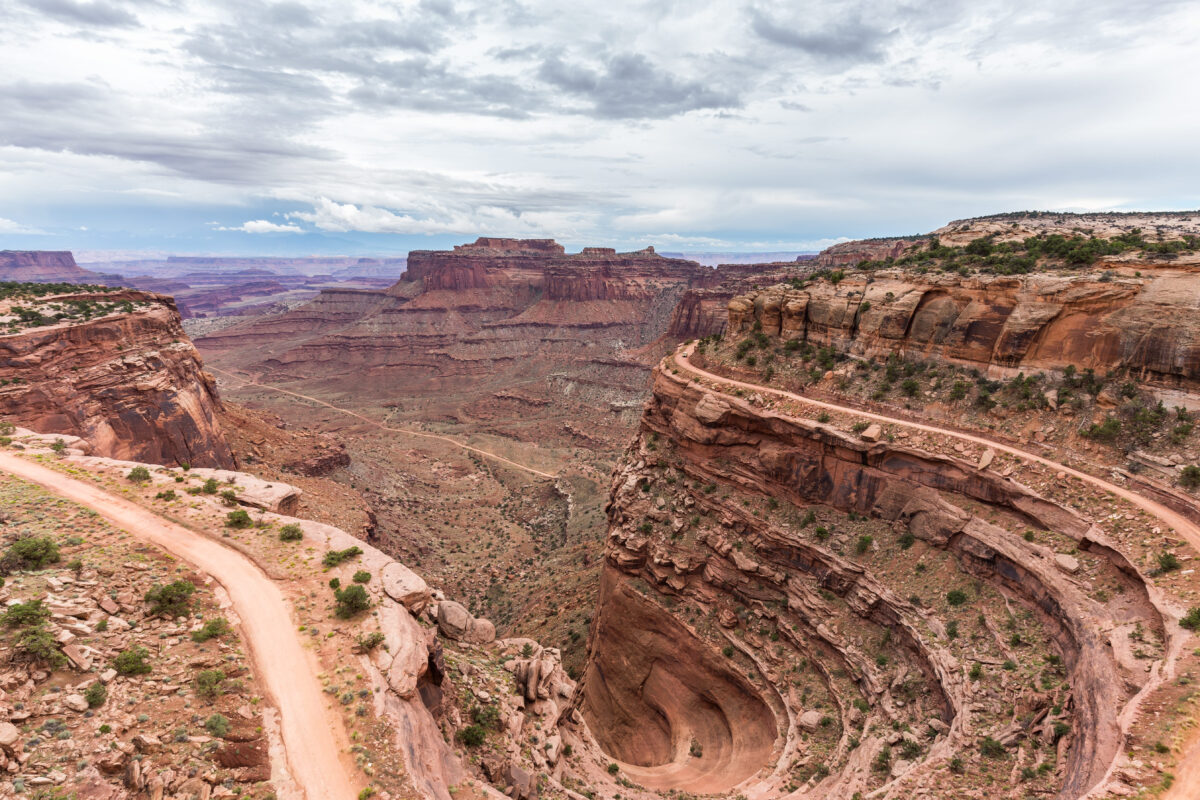
The Maze is dangerous in a quieter, more patient way. It does not need knife-edge ridges or steel cables to punish mistakes.
Canyonlands National Park says The Maze lies another three to six hours by high-clearance four-wheel-drive vehicle from Hans Flat Ranger Station, with no services, food, gas, or potable water in the district. The park also warns that GPS units can lead visitors astray and strongly recommends maps.
This is the kind of landscape where one wrong turn, one broken vehicle part, or one underestimated water plan can become a survival problem. Backcountry permits are required for overnight trips and for some day-use activities, including certain four-wheel-drive travel.
We should plan The Maze like a remote expedition, not a scenic detour from Moab. That means spare tires, recovery gear, paper maps, extra water, emergency communication, conservative mileage, and an itinerary filed with someone who will act if we do not return.
Barranco del Infierno in Tenerife
Barranco del Infierno means “Hell’s Gorge,” and the name fits the scenery better than the managed visitor system. The trail cuts through volcanic rock, protected habitat, and a narrow ravine near Adeje, where the weather can change quickly, raising the risk level.
The official rules require helmets, suitable footwear, weather awareness, and staying on the main path. Visitors are advised not to enter during windy or rainy weather due to landslide risk.
The beauty of this route is its controlled intensity. Unlike remote wilderness hikes, Barranco del Infierno uses rules to balance foot traffic, conservation, and safety.
Camping, overnight stays, canyoning, climbing, abseiling, littering, fires, smoking, pets, and bathing in the gorge are prohibited.
We should see those restrictions as the reason the trail can remain open at all. A fragile ravine with rockfall risk cannot absorb careless behavior forever.
Orla Perć in Poland’s Tatra Mountains
Orla Perć, or the Eagle’s Path, is one of Europe’s most feared public mountain trails because it blends hiking, scrambling, ladders, chains, and exposed ridge movement in a compact alpine setting.
Tatra National Park has about 275 kilometers of marked trails, and its steep, technically demanding places include artificial aids such as chains, ladders, and rungs.
That sounds reassuring until weather, ice, fatigue, or crowding turns those aids into bottlenecks.
The Tatras are small compared with the Alps, but they are not gentle. TOPR, the Tatra rescue service, reminds visitors that current conditions on marked trails are updated daily by Tatra National Park and that conditions safe for one person can be deadly for another, depending on experience, equipment, and skill.
We should check official trail conditions before attempting Orla Perć, start early enough to be off exposed terrain before storms or darkness, and avoid the ridge when wet, icy, snowy, or crowded.
Cascade Saddle Route in New Zealand
Cascade Saddle Route in Mount Aspiring National Park is the kind of hike that looks clean on a map and complicated underfoot. New Zealand’s Department of Conservation describes it as an alpine crossing that should not be attempted in adverse weather.
The Matukituki side includes steep snow grass slopes that become treacherous when wet, snow-covered, or icy, and sudden cold storms can bring snow even in summer.
The route also carries avalanche danger from June to November, and early summer may still require crampons and ice axes. Multiple unbridged streams can flood after rain or snowmelt, and DOC warns that hikers may need to wait for rivers to drop before crossing.
We should carry a tent or emergency shelter, spare food, a head torch, navigation tools, warm layers, and the judgment to delay or retreat. Cascade Saddle does not forgive schedule obsession. The safest plan is the one flexible enough to stop.
Mount Fuji in Japan

Mount Fuji is famous, sacred, photogenic, and crowded, yet it remains a high mountain. The official Mount Fuji climbing site lists the Yoshida Trail season for 2026 as July 1 through September 10, with a possible delayed start depending on weather or remaining snow.
The Yoshida Trail has a 4,000-yen hiking fee, a daily climber limit, and gate closures from 2 p.m. to 3 a.m. for climbers not staying in mountain lodges.
The danger on Fuji often comes from underestimating the mountain because so many people climb it. Cold, wind, altitude symptoms, darkness, crowding, fatigue, and poor footwear can turn a famous bucket-list climb into a medical problem.
Officials require winter clothes, two-piece rain gear, and appropriate climbing footwear to be checked at the 5th station for Yoshida Trail access.
We should book huts early, avoid bullet climbing, carry layers, bring a headlamp, pace slowly, and treat the summit as optional if the body or weather says stop.
How to Prepare for a Dangerous Hike That Is Still Open
We should prepare for these routes by matching the plan to the actual hazard, not to the photos. A cliff trail needs dry conditions, grip, spacing, and calm movement. A desert route needs water, navigation, vehicle readiness, and emergency communication.
An alpine route needs weather judgment, insulation, river-crossing skill, and the humility to turn around. A regulated boardwalk requires timed entry, adherence to rules, and respect for staff instructions.
The smartest hikers do not try to remove risk completely because that is impossible on routes like these. They reduce avoidable risk before the first step.
They read official updates, book required permits, plan for delays, start early, avoid bad-weather windows, and refuse to let sunk costs drive decisions.
The trail being open simply means access is legally possible. It does not mean the day is safe for everybody, every group, or every forecast.
Key Takeaway
The world’s most perilous hikes still open to the public survive because access and danger are managed together.
Huashan uses harnesses, Caminito del Rey uses timed entry and helmets, Yosemite uses a permit lottery, Canyonlands uses backcountry permits, and Hawaii uses camping rules and reservation systems. These controls do not weaken the adventure. They keep the adventure from becoming chaos.
We should never confuse public access with personal readiness. A dangerous trail is not conquered by reaching the end. It is respected by making the right calls before, during, and after the hike.
The strongest hikers are not the ones who push through every warning. They are the ones who know exactly when to keep moving, when to wait, and when to walk away.