Lake Mead Hits Lowest Level Ever Recorded
America’s largest reservoir has reached another troubling milestone, with Lake Mead falling to a historic low as drought, weak snowpack and relentless demand tighten the squeeze on the Colorado River.
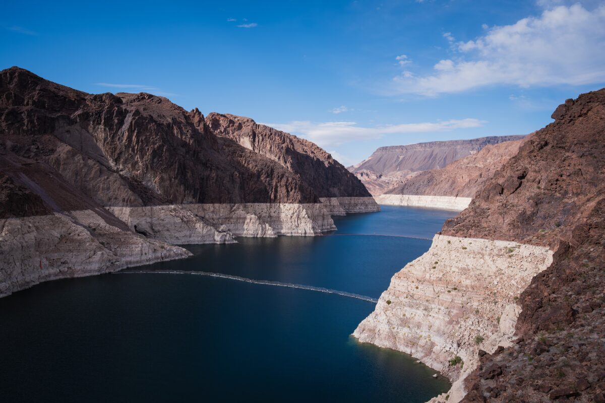
Lake Mead’s shrinking shoreline has been telling the same story for years. Now, the reservoir along the Arizona-Nevada border has reached a point that once seemed extraordinary, pushing water levels to their lowest range since the lake was filled after Hoover Dam was built in the 1930s.
The decline did not arrive without warning. By July 28, Lake Mead stood at about 1,041.17 feet above sea level, barely above the previous record low of approximately 1,040.58 feet reached in July 2022, according to federal data.
By Aug. 5, the reservoir had fallen to roughly 1,040.84 feet, leaving it less than four inches above that previous record. The latest drop comes during a year when exceptionally poor snowpack and runoff have placed extraordinary pressure on both Lake Mead and Lake Powell.
A record year in the making
Lake Mead is not simply another lake in the desert. It is a central storage point in the Colorado River system, which provides water for communities, farms and businesses across Arizona, California, Nevada and Mexico.
The broader Colorado River Basin supports roughly 40 million people and about 5.5 million acres of agricultural land.
That makes what happens at Lake Mead important far beyond the exposed rocks and expanding shoreline visible near Las Vegas.
The reservoir’s problems stretch back decades. Water levels have generally declined since the beginning of the century as prolonged drought, warmer conditions and demand have strained a river system whose supplies are shared among seven U.S. states and Mexico.
This year added another severe blow. Researchers and water managers began sounding alarms after unusually weak winter snowpack produced disappointing runoff into the Colorado River system.
Most of the water feeding the river originates as mountain snow. When that snowpack is small, there is less runoff available to replenish massive reservoirs after cities, farms and other users take their annual shares.
Federal projections earlier this year warned that Lake Mead could drop to around 1,036 feet during 2026, below its previous historic minimum. Those forecasts were based on different possible runoff scenarios and reservoir operations.
Lake Mead and Lake Powell are both under pressure
The crisis becomes even more striking when Lake Mead is considered alongside Lake Powell, the country’s second largest reservoir.
By late July, Lake Powell stood at about 3,522.78 feet, approaching its own previous record low of 3,519.92 feet set in 2023. Federal projections indicated Powell could establish another record low during August.
Together, Mead and Powell have already entered historic territory. Researchers reported in July that the two reservoirs had fallen to their lowest combined storage level since 1957, when Glen Canyon Dam was still under construction, and Lake Powell had not yet been fully created.
That matters because the reservoirs function almost like enormous savings accounts for the Colorado River.
Water collected during wetter years can help carry the West through dry periods, but repeated withdrawals without comparable replenishment steadily reduce that cushion.
The situation also raises concerns about hydroelectric power. Lake Powell is approaching the elevation at which Glen Canyon Dam can no longer produce electricity normally.
At roughly 3,490 feet, the reservoir reaches what officials call minimum power pool, meaning its water would be too low for standard hydropower operations.
Lake Mead remains considerably above the elevation where water could no longer flow through Hoover Dam, so a record low does not mean Las Vegas or other Western cities are suddenly about to lose their water supplies.
Still, each new low provides another warning about how much storage has disappeared.
The West now faces decisions it can no longer postpone
The declining reservoirs arrive at an especially difficult moment for Western water politics.
Rules that have helped govern operations of Lake Mead and Lake Powell are reaching the end of their current framework, forcing federal officials, states and tribes to negotiate a new approach for dividing increasingly scarce Colorado River water.
Those negotiations have proven difficult. California, Arizona and Nevada make up the Lower Basin states. At the same time, Colorado, Wyoming, Utah and New Mexico form the Upper Basin group, and the two sides have disagreed over how future shortages should be shared.
Officials have already turned to conservation programs to keep more water in Lake Mead. In July, the Metropolitan Water District of Southern California approved an agreement under which the federal government could provide up to $65 million for the agency to leave as much as 200,000 acre-feet of Colorado River water in the reservoir during 2026.
Such programs can slow the decline, but they do not change the underlying arithmetic. The river system cannot indefinitely deliver more water than nature supplies.
Cities across the Southwest have made significant conservation gains, and Las Vegas in particular has invested heavily in recycling indoor water and reducing outdoor consumption.
Agriculture, which accounts for a large portion of Colorado River use, is also expected to remain central to negotiations over future reductions.
The implications stretch beyond household faucets. Colorado River water supports farms that produce food for consumers nationwide, recreation economies surrounding the reservoirs, wildlife habitats and hydroelectric facilities that supply power across the region.
Visitors to Lake Mead can already see the transformation firsthand. The famous white “bathtub ring” around the reservoir marks where water once covered the surrounding rock, while previously submerged terrain continues to emerge as the shoreline retreats.
The reservoir has recovered from severe declines before, and future winters could bring better snowpack. But one wet season cannot erase decades of imbalance.
Lake Mead’s newest low is therefore more than another number on a federal water gauge. It is a visible measure of how narrow the West’s margin for error has become, and how quickly difficult choices about the Colorado River are moving from future warnings to present reality.